Sights
Startseite > Sehenswürdigkeiten > National Park ,,Sallandse Heuvelrug”
National Park ,,Sallandse Heuvelrug"
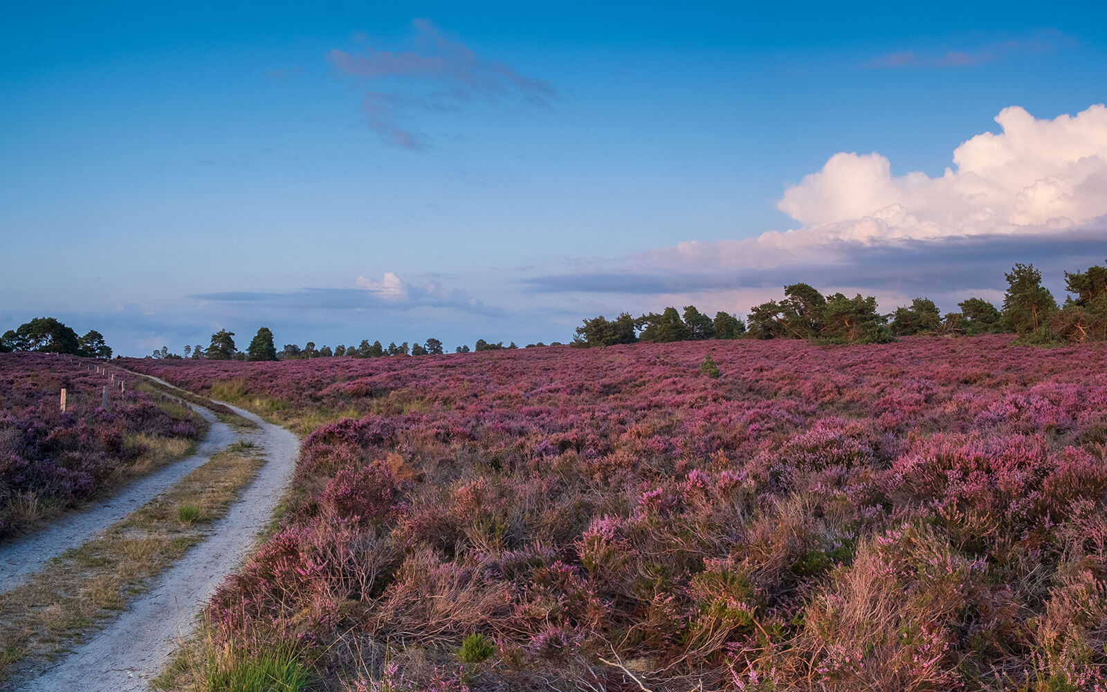
The Sallandse Heuvelrug National Park is located in the province of Overijssel in a triangle between the trunk roads (Dutch provinciale weg) N35 to the north, N332 to the southwest and N350 to the southeast, the nearest village being Nijverdal, which borders immediately to the east.
Since the Middle Ages, the originally forested area has consisted mainly of extensive heathland, and in places the subsoil is completely devoid of vegetation. In these places there are inland dunes formed by sand drifts. As the name Sallandse Heuvelrug suggests, the area of the national park is quite hilly by Dutch standards; the highest elevation in the park is the Grote Koningsbelt, which is about 75 meters high, making it also one of the highest places in the province.
- Nijverdalsebergweg, Nijverdal, Netherlands
The Sallandse Heuvelrug National Park is located in the province of Overijssel in a triangle between the trunk roads (Dutch provinciale weg) N35 to the north, N332 to the southwest and N350 to the southeast, the nearest village being Nijverdal, which borders immediately to the east. Since the Middle Ages, the originally forested area has consisted mainly of extensive heathland, and in places the subsoil is completely devoid of vegetation. In these places there are inland dunes formed by sand drifts. As the name Sallandse Heuvelrug suggests, the area of the national park is quite hilly by Dutch standards; the highest elevation in the park is the Grote Koningsbelt, which is about 75 meters high, making it also one of the highest places in the province. In order to counteract further erosion and drift sand formation, the mounds have been protected since about the end of the In the 19th century, large areas were reforested, mainly with pine trees. This practice was discontinued towards the end of the 20th century, in order to preserve the culturally and historically significant heath landscapes. In the west of the national park lies the country house De Sprengenberg, built between 1900 and 1910, on the hill of the same name. This is also called Palthetoren (after the Dutch patrician family of Palther and the Dutch word toren for tower) by the inhabitants of the region and has the official status as a rijksmonument. The ridge of hills is a striking feature of the Overijssel landscape. The individual hills are visible from all directions even from a great distance.
By loading the map, you agree to Google's privacy policy.
Learn more